There is no single “best time” for the Mojave corridor. The territory is too large and too varied. What’s ideal for running Death Valley — November through March — is the same window when the Colorado Plateau is dealing with winter storms and the Moab area is either frozen or a mud pit. Sorting out when to run what requires treating each region as its own thing.
Low Desert: Eastern Mojave, CA and Southern Nevada

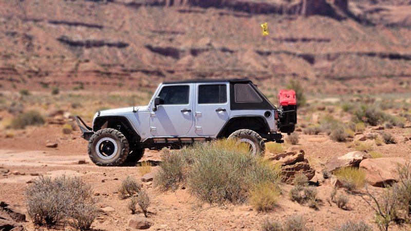
Best window: October through April. This covers Death Valley, Mojave National Preserve, the Eastern Mojave between I-15 and I-40, and the Southern Nevada basin and range south of US-93. Daytime highs in the 60s–70s°F, overnight lows in the 40s–50s°F. Comfortable working conditions, no heat risk, good light for photography.
May starts warming fast. By June the low desert is genuinely dangerous — Death Valley records regularly exceed 120°F in July. Furnace Creek has documented temperatures above 130°F. This is not aggressive summer running territory. The heat is not inconvenient; it is life-threatening. Summer running in the low Mojave requires serious heat management, maximum water capacity, and mechanical preparation for extreme thermal conditions. We don’t do it casually.
Pro Tip
October and November hit the sweet spot for most first-timers in the low Mojave — comfortable working temperatures, cool nights, and routes that haven’t started to see spring crowds yet. February through April can be spectacular in a good rain year, but wildflower seasons draw significant traffic to popular corridors. If you’re planning a Mojave Road run or any route through the Preserve in spring, go on weekdays and have a backup plan. The roads are fine; the parking at trailheads is not.
Arizona Corridor: Kingman Area, Mohave County, Oatman
Best window: October through May. The Arizona high desert at 3,000–5,000 feet elevation runs cooler than the low Mojave but follows a similar summer heat pattern. The Kingman area, Oatman, and the BLM land in Mohave County are ideal in fall and spring — comfortable temps, passable roads, no monsoon complications. Summer brings the Arizona monsoon season (July–September), which drops significant rain in short bursts. Flash flood risk is real on canyon roads and dry washes during monsoon. Roads that were passable in June can be running water or washed out by August.
Heads Up
October through early December and March through May are where Arizona consistently delivers. The Oatman area and the Route 66 corridor stay drivable in most winter conditions — snow is possible above 4,500 feet but lower elevation BLM routes through Mohave County stay accessible year-round. The Hualapai Mountains above Kingman are a different story in January and February; those roads ice and the switchbacks don’t forgive mistakes. Stay on lower elevation BLM land if you’re running Arizona in deep winter. Spring in Arizona also comes with one underrated perk: desert wildflowers hit differently at elevation. The timing is later than the low Mojave — late March through April — and the crowds are a fraction of what you’ll find at Antelope Valley or Joshua Tree.
Southern Utah: Canyon Country and Moab Area
Best windows: March–May and September–November. The Colorado Plateau operates on a different seasonal rhythm than the low desert. Moab and the canyon country around Canyonlands and Arches see genuine winter — snow, ice, frozen roads — from December through February. Spring (March–May) opens the trails as snow melts and is generally considered the premier season: moderate temps, good light, fewer crowds than peak summer.
Summer (June–August) is hot by canyon country standards — highs in the 90–100°F range — but manageable compared to the low Mojave. The payoff for summer running in Utah is longer days and mostly dry conditions. Fall (September–November) is excellent: cooling temps, fall color in the higher elevations, and the dramatic late-afternoon canyon light that makes the sandstone glow.
Great Basin: Northern Nevada
Best window: June through September. The Great Basin runs at higher elevation than the Mojave proper — most of the basin and range terrain in northern Nevada sits between 4,000 and 6,000 feet. That means real winters with road closures from November through May on many routes, and cool to cold overnight temperatures even in summer. The short sweet spot is summer through early fall. Expect afternoon thunderstorms in July and August — not as severe as the Arizona monsoon, but enough to make dirt roads slick and creek crossings unpredictable.
Note
Planning a Multi-Region Trip
Most serious Southwest overlanding trips stitch together two or three of these regions. The pairing that works nearly year-round is the Arizona corridor combined with the low Mojave — both have tolerable winter conditions and both go extreme during the same summer heat window. Add Utah canyon country and you’re looking at late April through May or September through October as your overlap window. Add the Great Basin and you’re committed to summer, which means planning around afternoon thunderstorm patterns instead of heat.
The biggest planning mistake is treating the Southwest desert as a single climate. It’s not. Death Valley in October and Moab in October are completely different experiences — different gear, different hazards, different road conditions. Map out your route, check conditions for each segment separately, and build in flexibility. The desert doesn’t care about your schedule.