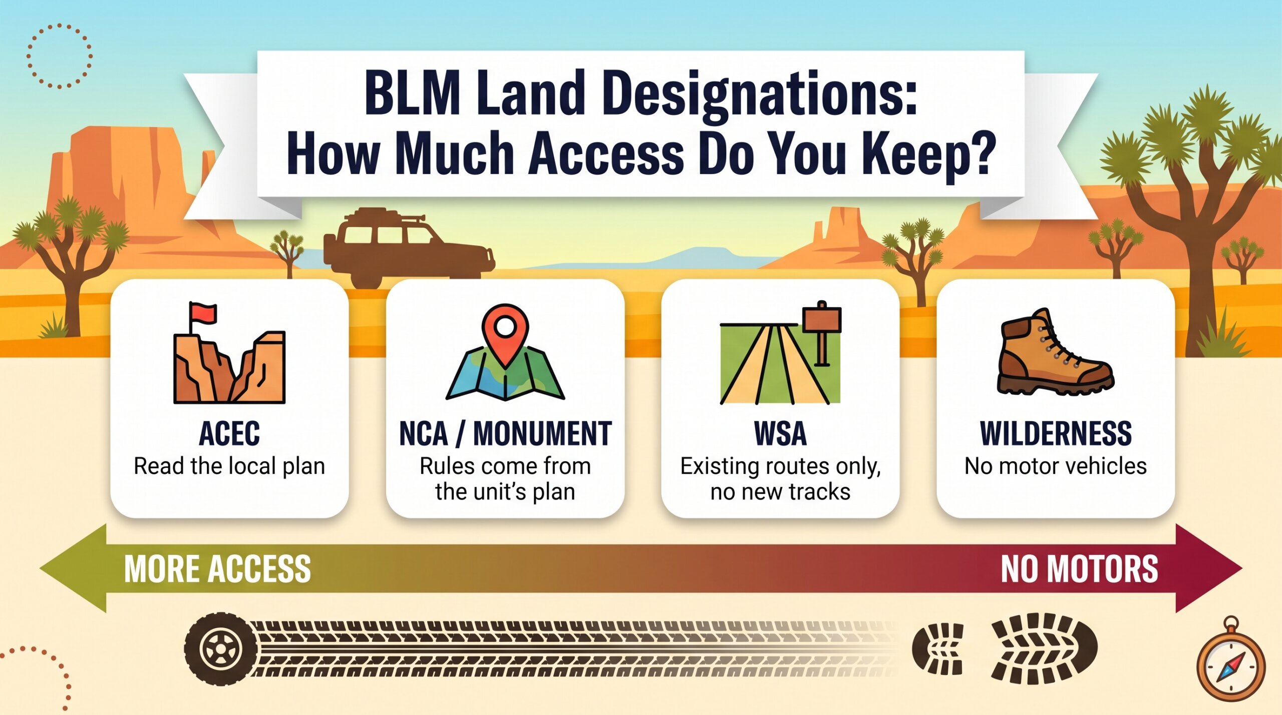
The letters on a BLM map tell you which rules apply before you ever see a sign. An ACEC usually means “watch where you drive and camp, and read the local plan.” A Wilderness Study Area means tightly limited vehicle travel on ground that is managed almost like wilderness. Designated Wilderness means no motor vehicles at all. A National Conservation Area or national monument means protection layered on top of a management plan that sets the travel rules. Below we take each one in turn, cover who can change them (several are in flux right now), and end with a five-minute way to check a route before you commit to it.
This is the deeper follow-up to our BLM land access rules guide, which covers who manages what and how dispersed camping works. Here we stay on the designations themselves.
The Quick Version
| Designation | Who creates it | What it protects | What it usually means for a driver |
|---|---|---|---|
| ACEC (Area of Critical Environmental Concern) | BLM, through a resource management plan | Specific cultural, scenic, wildlife, or natural-system values | Varies by area. Access continues unless the plan says otherwise. |
| WSA (Wilderness Study Area) | Congress ordered the review; BLM identified the areas | Wilderness qualities, until Congress decides | Motor vehicle use tightly limited. No new routes. |
| Designated Wilderness | Congress | Roadless, undeveloped land | No motor vehicles. |
| NCA (National Conservation Area) | Congress | Whatever the enabling law names | Set by the unit’s management plan. |
| National Monument | President or Congress | Objects named in the proclamation | Set by the monument’s management plan. |
Start With the Default: Most BLM Land Has No Special Label
Most BLM ground is managed for “multiple use,” which is why dispersed camping and open roads are the norm. A designation is a layer of extra management attention added to that default. The Federal Land Policy and Management Act of 1976 (FLPMA) is the law behind most of these layers, and it shows up in all three of the designations below.
ACECs: Flexible, Plan-Level, Easy to Miss
An Area of Critical Environmental Concern is public land where BLM decides special management attention is needed to prevent irreparable damage to historic, cultural, or scenic values, fish and wildlife, or natural systems. FLPMA is the legal basis, and BLM designates them through its resource management plans (RMPs). Members of the public can nominate candidate areas during planning, BLM tests each one for relevance and importance, and the designation becomes official when the final plan clears its protest period.

What we like to tell people is that an ACEC is a flag, not a fence. BLM’s own description is that development can continue in an ACEC if it is consistent with protecting the values that earned the designation, and that recreation and public access are balanced against protection. In practice, the restrictions live in the plan for that specific area: a seasonal closure to protect nesting, a route limited to protect rock art, a no-surface-disturbance rule near a spring. Nine Mile Canyon in Utah, which BLM highlights for having the nation’s greatest concentration of rock art sites, is one example.
The practical takeaway: an ACEC label on a map tells you to go read what that ACEC’s plan says before you assume the usual dispersed-camping rules.
Wilderness Study Areas: The Tightest Rules on Open BLM Ground
WSAs come from a 1976 order and a 1980 inventory. Congress told BLM to find roadless areas of at least 5,000 acres with wilderness qualities, and BLM did, ending up with hundreds of them. BLM now manages roughly 487 WSAs covering about 11 million acres, with Utah (2.79 million acres in 77 WSAs) and Nevada (2.51 million acres in 60 WSAs) among the largest holdings, according to a 2020 Congressional Research Service count.
They are managed under a “non-impairment” standard. Until Congress decides to designate an area as Wilderness or release it, BLM must avoid activities that would impair its suitability for wilderness. Uses generally have to be temporary and cause no new surface disturbance. Some grandfathered uses that pre-date FLPMA, such as certain grazing and mining operations, continue under regulation.

For drivers, the short version is that WSAs are not places to improvise. BLM describes them as open to non-motorized recreation. Established primitive routes can remain open in some cases, but creating a new route is new surface disturbance and typically off the table. That means no following someone else’s fresh tracks, no widening a two-track, and no pulling off across open ground. If a route through a WSA shows on your map, confirm it is signed open before you commit.
One thing to know about right now: BLM opened a public policy review of Manual 6330, the manual that governs WSA management, with comments open through August 14, 2026. The notice does not say what changes are being considered, so we are not predicting anything. It does mean the rules on some WSAs could shift in the coming year.
Designated Wilderness: Where the Truck Stops

Designated Wilderness is the Congress-created, permanent version of what a WSA might become. BLM manages 263 wilderness areas totaling over 10 million acres. Motor vehicles are generally prohibited. If you are running a route that touches one, expect the boundary to be a hard line, and expect the road to end or the route to skirt the edge. Mojave Trails National Monument, for example, includes over 350,000 acres of designated wilderness inside its 1.6 million acres.
NCAs and National Monuments: Protection With a Plan Attached
BLM’s National Conservation Lands system groups together 937 units covering more than 38 million acres. It includes national monuments, National Conservation Areas, wilderness, WSAs, wild and scenic rivers, and national scenic and historic trails.
The two designations most drivers actually encounter are worth separating:
- National Conservation Areas are designated by Congress. The enabling law names what the area is meant to protect.
- National Monuments can be established by the President under the Antiquities Act of 1906 or by Congress, and the proclamation names the “objects” being protected.
Neither label carries a single blanket vehicle rule. The travel rules come from each unit’s own management plan, so they differ. Two Mojave-corridor examples show the range:

Mojave Trails National Monument (California), established February 12, 2016, protects 1.6 million acres including the longest remaining undeveloped stretch of Route 66 and the Mojave Road corridor. BLM describes off-highway vehicle use as a traditional use there, recommends high-clearance 4×4 for the unpaved roads, and allows dispersed camping on BLM land with a 14-day limit per site and no permit or fee.
Gold Butte National Monument (Nevada), nearly 300,000 acres in Clark County established in December 2016, allows motorized and mechanized travel on open roads only. BLM marks closed roads with signs, and route designations there date to 2008. Primitive camping is available along the 62-mile Gold Butte Backcountry Byway, where the last 19 miles need high clearance. BLM issued interim management guidance in December 2024.
The pattern in both: the monument label does not by itself close the roads. The plan and the signs do.

Who Can Change a Designation (and What Is Shifting in 2026)
Designations feel permanent when you are looking at a map, but each one has a specific mechanism for change, and three of them are moving right now.
ACECs. A 2024 BLM rule had added a presumption favoring designation and temporary protection for nominated areas. BLM rescinded that rule effective June 11, 2026, restoring the older 1983 procedure. ACECs are again designated through the regular planning process, and an area must meet relevance and importance criteria.
WSAs. Only Congress can designate a WSA as Wilderness or release it from study, and legislation is usually regional, covering a county or state. Separately, BLM’s Manual 6330 review is underway, as noted above.
National monuments. On July 13, 2026, presidential proclamations reduced Grand Staircase-Escalante from roughly 1.87 million acres to about 181,500 and Bears Ears from roughly 1.36 million acres to about 121,100, effective September 11, 2026. The excluded land stays public but loses monument-level protection, which opens it to new mining claims and mineral leasing. Conservation groups have challenged the reductions in court, and the outcome is unsettled. If you plan to run Utah backroads near either monument, check current boundaries and the land-use plan that applies to the specific parcel you are on.
For anything in this section, our advice is the same: treat the map you saved last year as a starting point, not the final word.
How to Check a Designation Before You Go
This takes about five minutes and covers most of the surprises.
- Turn on the public-land layers in your mapping app. Look for wilderness, WSA, and monument boundaries. Treat the layer as a flag, not an authority, because layers can lag behind changes.
- Find the unit’s page on blm.gov. National monuments and NCAs have dedicated pages that list travel and camping information, and most link to the management plan.
- Call or email the local BLM field office for anything you plan to drive that is inside or next to a designation. Ask specifically about route status and any seasonal closures.
- Trust signs over apps. Closed roads are marked on the ground. If a route you plan to run is not signed open, treat it as closed.
- Note the fire and closure pages. Fire restrictions and temporary closures are posted separately from the designation itself.

Quick Answers
Can you camp in a Wilderness Study Area? BLM lists camping among the non-motorized recreation uses WSAs are open to. Dispersed camping rules still apply, but you get there on foot or by an established open route, not by driving off-route.
Is a BLM national monument the same as a national park? No. BLM monuments sit inside the National Conservation Lands system and follow their own management plans, so camping and travel rules differ from unit to unit. Mojave Trails, for example, allows dispersed camping on BLM land.
Does an ACEC close an area to vehicles? Not automatically. Restrictions depend on the plan for that specific ACEC.
Who decides if a WSA becomes Wilderness? Congress, by legislation.
Where to Learn More
- BLM: Areas of Critical Environmental Concern
- BLM: Wilderness and Wilderness Study Areas
- BLM: National Conservation Lands
- BLM: Mojave Trails National Monument
- BLM: Gold Butte National Monument
- Congressional Research Service: BLM Wilderness Study Areas in Brief
- Federal Register: Rescission of the Conservation and Landscape Health Rule
Related on Mojave Overland: BLM Land Access Rules · How to Find Places to Camp · Leave No Trace for Overlanding
