Moab, Utah sits five miles south of the Arches National Park entrance and about thirty miles from Canyonlands’ Island in the Sky district, which is why nearly every overlander running Utah’s canyon country ends up passing through it at some point. It’s less a single stop than a basecamp — the town you fuel up in, eat in, and stage from before dropping onto whatever backcountry route you’re actually here to run. Here’s what’s worth knowing about the place itself.
From Uranium Boom to Overland Basecamp
Moab’s name goes back to the 1880s — a local farmer named William Pierce suggested it, borrowing the biblical Moab as a nod to the region’s dry climate, and became the town’s first postmaster. For the next several decades it was a ranching and farming valley, not a tourist stop: telephone lines arrived in 1908, a bridge over the Colorado River in 1912, electricity in 1915.
The town’s real transformation happened almost overnight. On July 6, 1952, prospector Charlie Steen struck one of the richest uranium deposits in the country just outside town. Moab’s population jumped from around 1,200 to 6,500 in a few years as it became the self-declared “uranium capital of the world.” The boom didn’t last — the Atomic Energy Commission stopped buying in 1958, and prospecting dried up almost as fast as it had started. By 1963 the Chamber of Commerce had rebranded the town “Heart of the Canyonlands” instead, betting on tourism. The last uranium mill closed in 1984, and the pivot to outdoor recreation that followed is the Moab you’re driving into today.
Why the Landscape Looks Familiar
If Moab’s red rock feels like you’ve seen it before, you probably have. John Ford shot Wagon Master and Rio Grande here in 1949 and 1950, using Professor Valley and the Colorado River corridor, and the town has been a working backdrop ever since. Thelma & Louise used the Shafer Overlook and Arches in 1990. Con Air and Mission: Impossible II both shot at Dead Horse Point. 127 Hours filmed in Blue John Canyon and Sand Flats. Transformers: Age of Extinction used Hole N” The Rock, below. Ridley Scott has said he saw more usable scenery in one day scouting Moab than anywhere else he’d worked. It’s worth knowing going in — some of the overlooks and formations you’ll recognize aren’t a coincidence.
Two National Parks, One Town Between Them
Arches is the closer of the two — five miles north of town on 191, with terrain running from about 4,085 to 5,653 feet. Canyonlands’ Island in the Sky district is the Canyonlands entrance most people run from Moab, about thirty miles southwest, and it sits higher, up around 6,200 feet.
Worth knowing right now: Arches dropped its timed-entry reservation requirement for 2026, after running it as a pilot since April 2022 to deal with a 74% jump in visitation over the previous decade. You can drive in without a reservation this year — but Devils Garden Campground and the Fiery Furnace permit hikes still require booking ahead, and Grand County commissioned a $60,000 economic study, due by the end of April 2026, to see how the change affects visitation, lodging, and local tax revenue — the park hasn’t said whether that data will decide if timed entry comes back. Don’t assume next season works the same way this one does.
Sand Flats and the Trails That Made Moab, Utah’s Reputation
The reason Moab shows up in every off-road conversation is Sand Flats Recreation Area, a stretch of slickrock jointly run by Grand County and the BLM that holds Hell’s Revenge and Fins and Things — two of the most recognized 4×4 trail names in the country, out of roughly 30 miles of trail in the area. It’s a fee area, not free BLM dispersed land — $15 per night per vehicle at any of the 140 first-come sites, $80 per night for one of the 6 reservable group sites, so budget for that if Sand Flats is the plan.
Easter Jeep Safari — Moab’s Biggest Week
If you only know one thing about Moab’s off-road culture, it should be this: for one week every spring, the town’s entire identity is Easter Jeep Safari, and it’s the closest thing the wheeling world has to King of the Hammers in cultural weight. It started small — a single-day promotional ride on the Behind the Rocks trail in 1967, put on by the Chamber of Commerce to pull in tourists. The Red Rock 4-Wheelers run it now, and it’s grown into a nine-day, fully permitted event. The 2025 running (the 59th) pulled over 1,500 registrations representing almost 4,000 participants, 147 groups spread across 40 trails, and more than 400 volunteers to keep it running — sold out, by the club’s own account. Past years have put close to $500,000 into local sales and lodging tax receipts in that single week. 2026 is the 60th anniversary, running March 28 through April 5, with a vendor expo and vintage-Jeep car show alongside the trail runs.
It matters even if you’re not registered. The BLM closes several of Moab’s best-known trails — Behind the Rocks, Cliffhanger, Gold Bar Rim, Golden Spike, Moab Rim, Poison Spider Mesa, and Pritchett Canyon among them — to the general public on their scheduled Safari dates so registered groups can run them without conflict. Lodging and camping book out well ahead of the week, and traffic through town is heavier than any other stretch of the year. If you’re building a spring trip around Moab and Safari isn’t the point, plan your dates around that week rather than into it. If it is the point, register early — this one sells out.
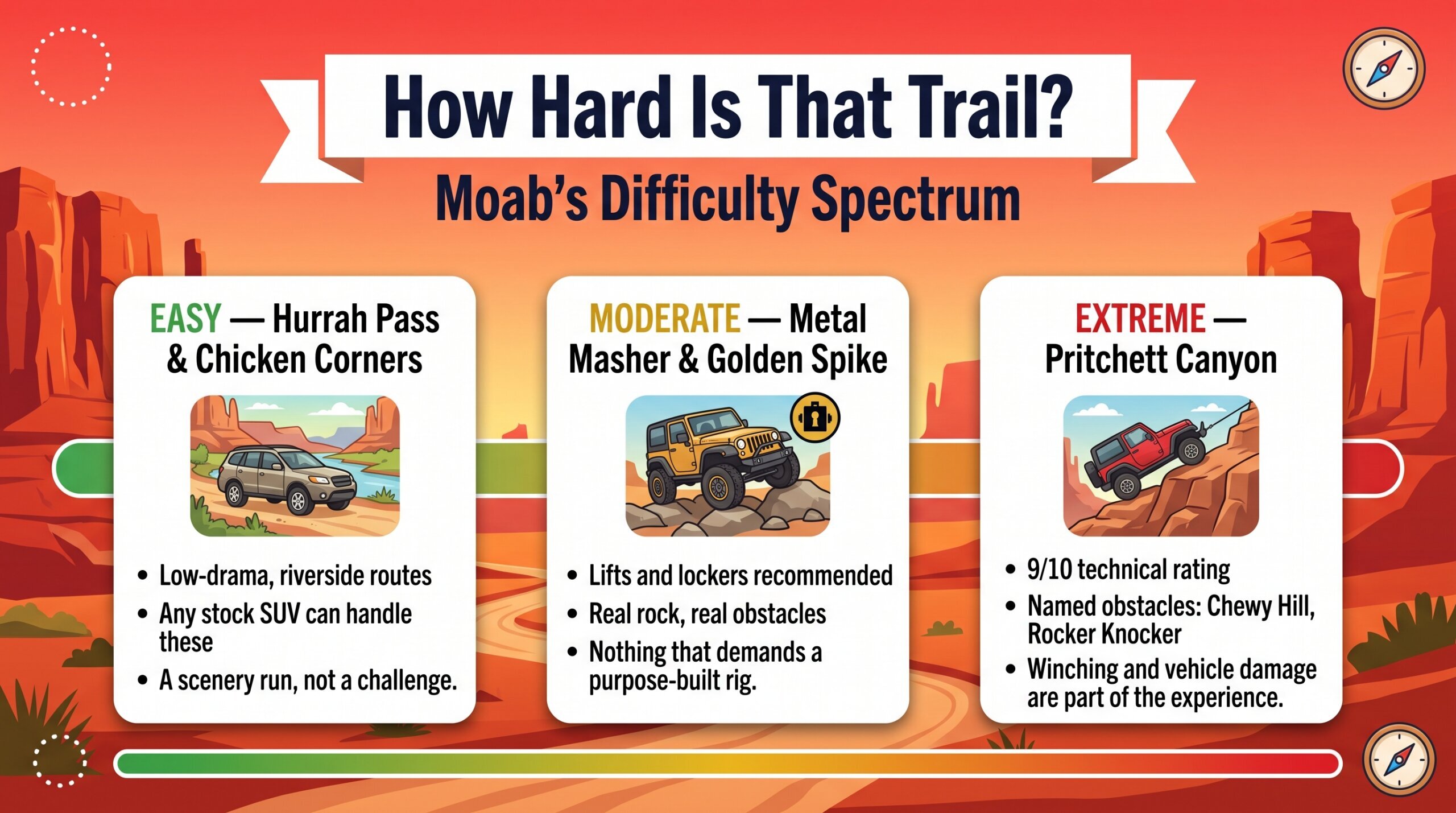
The reason Safari can spread 147 groups across 40 different trails without doubling anyone up is that the trail network around Moab is genuinely enormous — nearly 2 million acres of public land threaded with thousands of routes, and it runs the full difficulty spectrum in a way few other off-road destinations do. On the approachable end, Hurrah Pass and Chicken Corners are riverside, low-drama routes any stock SUV can handle, good for a scenery run rather than a challenge. Step up and you’re into Metal Masher and Golden Spike territory — lifts and lockers recommended, but nothing that demands a purpose-built rig. Then there’s the trail that’s closed during Safari week for a reason: Pritchett Canyon, carrying a 9/10 technical rating and named obstacles like Chewy Hill and Rocker Knocker that regularly involve winching and vehicle damage as part of the experience, not a worst-case scenario. Knowing where a trail sits on that spectrum before you commit to it matters more in Moab than almost anywhere else we cover — the gap between “moderate” and “extreme” out here is bigger than the labels suggest.
Outfitters, Jeep Rentals, and Gear Shops
You don’t need your own rig to run Moab’s trails. Moab Adventure Center, Moab Tour Company, and Epic 4×4 Adventures all run guided and you-drive trips on the well-known routes — Hell’s Revenge and Fins and Things chief among them — in their own Jeeps and UTVs, so the trail research and vehicle prep are already handled. If you’d rather be behind your own wheel without trailering a rig into town, Moab has one of the highest concentrations of Jeep rental outfits in the Southwest: Cliffhanger Jeep & UTV Rentals, Jenn’s Jeep Rentals, Canyonlands Jeep and Car Rentals, and the Moab Adventure Center’s own Rubicon fleet mean you can land in town, walk up, rent a lifted Wrangler for the day, and be out on Sand Flats within the hour. And if you flew in short on gear, downtown has that covered too — Gearheads Outdoor Store on Main Street and Moab Gear Trader both stock camping and off-road equipment, from recovery straps to backpacking stoves, if you forgot something or didn’t want to fly with it.

Camping Options Beyond Sand Flats
If you don’t want the Sand Flats fee, there’s real free dispersed camping on BLM land close to town, no permit required:
- Yellow Circle Road, about 11 miles south — flat, open, unnumbered sites, fine for 2WD.
- Behind the Rocks Road, about 16 miles south — sandy BLM road with red rock views; the front sites work for 2WD, the deeper ones want 4WD, especially after rain.
- Klondike Bluffs Road, about 20 miles north — popular with the mountain bike crowd, wide desert views, no amenities.
None of these have water, trash service, or a bathroom — pack out what you bring in, including waste, the same rule as everywhere else we cover this. Roads out here go from fine to impassable fast after rain, so check conditions before committing to a site you can’t back out of.
If you want to get further from pavement than any of these three, Canyonlands’ White Rim Trail is the next step up — a 100-mile permitted loop below the rim that we’ve run ourselves, camping above the Green River with nothing but canyon between us and the water. It requires its own backcountry permit and planning, which we cover in our guide to BLM and NPS land access rules.
Where to Eat When You’re Off the Trail
Moab, Utah’s food scene is bigger than you’d expect for the town’s size, which happens when a few hundred thousand visitors pass through every year. A few worth knowing by name rather than just wandering into whatever’s closest: Milt’s Stop & Eat — we’ve eaten here ourselves, and the burger’s good, but it’s the milkshakes that are worth the stop, eaten outside under their tree. Antica Forma for wood-fired pizza, Love Muffin for breakfast burritos if you’re getting an early start toward the parks, and the Food Truck Park downtown if the group can’t agree on one cuisine. If you want a sit-down dinner instead of trail food, Desert Bistro is the reservation-worthy option; Josie Wyatt’s is the more laid-back version of the same idea. The Spoke on Center is another one we can vouch for firsthand — right in the middle of town, we’ve been back twice, and the pub food holds up both times.
The Roadside Stop You Shouldn’t Skip
About twelve miles south of town on 191 is Hole N” The Rock — a 5,000-square-foot home Albert Christensen spent twelve years carving directly into a sandstone formation, finishing in the 1940s. It’s fourteen rooms built around the rock’s natural pillars, a fireplace with a 65-foot chimney drilled straight through the stone, and — this is real — a bathtub carved into the rock itself. Christensen and his wife Gladys ran it as a diner and later a roadside attraction; both are buried on the property. Today it’s tours, a gift shop, a small petting zoo, and a taxidermied donkey named Harry standing guard out front. It’s touristy in a way most of what we cover isn’t, and that’s exactly why it’s worth the ten-minute detour — it’s the kind of thing you’d miss entirely if you kept your head down and drove straight through to the trailhead.
Moab is the first entry in what’s going to be an ongoing series — the small towns that sit at the edge of the parks and public land across this corridor, one at a time, real firsthand information rather than a tourism-brochure rundown. More gateway towns to come as we actually spend time in them.
Where to Learn More
- Moab Museum — Beginnings & Development
- Moab Sun News — Uranium history
- Discover Moab — Movie Sites
- NPS Arches — Fees & Passes
- Grand County — Sand Flats Recreation Area
- Discover Moab — 60th Easter Jeep Safari
- BLM — Easter Jeep Safari trail restrictions
- onX Offroad — Best Moab Off-Road Trails
- The Hearnes — Moab Restaurant Guide
- Atlas Obscura — Hole N” the Rock
- Moab Times — Arches Drops Timed Entry for 2026
- Moab Times — Easter Jeep Safari Attendance Numbers
- onX Offroad — Pritchett Canyon Trail
- Moab Adventure Center — Dispersed Camping Near Moab
- Discover Moab — Maps & Location Info
- Trailmater Offroad Recovery (Rory Irish) — YouTube
